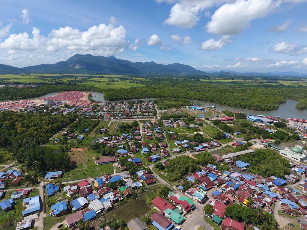
I AM in two minds about writing this piece on a recent trip to Gunung Jerai – a lesser-known hill station in the country – simply because I feel I have found a hidden gem that I would like to keep under wraps and protected from haphazard development that plagued other local hill resorts once demand for attractions, accommodation and recreational activities spike.
The word “Gunung Jerai” or “Mount Jerai” has been a familiar term since I embarked on a quest to explore Malaysian history and heritage. This site is however not within the radar of most local or foreign tourists.
Ancient sailors looked out for the peak of this mountain to mark their entry into one of the busiest maritime routes – the Strait of Melaka. The foot of this mountain was where the thriving ancient ports of the Bujang Valley – Sg Batu and Pengkalan Bujang – were located until receding sea levels pushed the coastline further westward – leading to the decline of these ancient maritime trading sites where evidence of international trade, a large iron smelting industry and multicultural society has been (and is still being) unearthed by archaeologists since the 1930s.
The abundance of minerals in the area, especially much valued iron and gold, is indicated by pegmatite lines at the peak of Gunung Jerai. Iron in particular was the reason why the Kingdom of Ancient Kedah which the Bujang Valley was a part of prospered.

The 10-km drive up to Jerai Hill Resort via narrow winding roads took about 30 minutes, with hardly any stops along the way. This resort is located within the Jerai National Geopark that is made up of 24 geosites, three geoarchaeological sites, one bio site and eight historical and cultural sites. Declared a geopark in 2017, it covers 816 sq km in the districts of Yan and Kuala Muda.
Padang Tok Sheikh is one of the most significant sites within this geopark. Located 1,150m above sea level, it is one of the oldest rock formations on mainland Peninsular Malaysia, formed during the Cambrian period 550 million years ago – back when this side of the world was a part of Gondwana, an ancient supercontinent.

This site has high heritage value being the oldest rock formation found in mainland Peninsular Malaysia, and the second oldest in the country after the Mat Chinchang range on Langkawi Island, which is a Unesco Global Geopark site that is recognised as the oldest rock formation in Southeast Asia.

The Padang Tok Sheikh rock formation was once a shallow seabed covered by mud clay and sand. Long periods of sedimentation caused this seabed to be buried deep in the earth’s surface and harden into rock over time.
It was pushed to the surface and its current position as a result of an episode of granite intrusion that occurred 220 million years ago during the Triassic period. This shift also resulted in the land mass we have today including the Titiwangsa Range that was formed about 250 million years ago.
The heritage value of this spot is confounded by the fact that this place is believed to be where the first call to prayer was performed in Peninsular Malaysia – by the 9th Sultan of Kataha (Kedah today) Sultan Muzaffar Shah (Maharaja Derbar Raja II).
The ruler was converted to Islam by Arab Sheikh Abdullah bin Sheikh Ahmad bin Sheikh Jaafar Qumiri in the 12th century AD – according to the ancient text Hikayat Merong Mahawangsa. This is a conflict of sorts with earlier accounts of Islam entering this part of the world through the Malacca Empire in the 15th century – but that is for another article.
Datuk Dr Mohktar Saidin, an archeologist and geologist, and former director of University Sains Malaysia’s Centre for Global Archaeological Research, said over 5,000 years ago the shoreline in the area was about 8-km inland.
It thus supported the development of a maritime settlement that had a thriving port, interaction between multi-ethnic and cultural communities and barter trading.

Based on his archeological findings, Mokhtar said that port cities like Sg Batu existed around 788 BC. These port cities including Pengkalan Bujang in Merbok started to decline following a drop in sea levels that saw the shoreline moved westward to where it is today.

The ecosystem in the area also included mangrove swamps, in which the wood was needed to produce charcoal required by the iron smelting industry. The iron smelting process needed temperatures of up to 1,200°C to melt iron ore sourced from the Bujang Valley.

In addition to this, raw materials like clay, granite and laterite used to make bricks and produce building materials, bases and pillars were abundant in the surrounding areas.
A workshop manufacturing granite structures was unearthed in Bukit Batu Pahat. Clay bricks can be seen in the remains of jetties, Hindu and Buddhist temples and other structures unearthed by archaeologists.

Some of the other attractions at Jerai Geopark include mangrove forests along the Merbok River estuary and tropical rainforests with endemic flora and fauna, islands like Pulai Bidan, Pulau Songsong, Pulau Sayak and Pulau Telur, ancient shorelines, geo disaster sites such as spots hits by the tsunami in 2004, museums and galleries, traditional villages, cuisine and socio-cultural practices.

Some of the best views from Gunung Jerai are from Jerai Hill Resort where the vast green paddy fields in the Yan district can be seen merging with the azure waters of the strait of Melaka – intermittently dotted with islands. – October 15, 2023


